


Kavire Loot
Kavire Loot or the Dasht-e Kavir, also known as Kavir-e Namak, and the Great Salt Desert, is a large desert lying in the middle of the Iranian plateau. It is about 800 km (500 mi) and 320 km (200 mi) with a total surface area of about 77,600 km2 (30,000 sq mi), making it the Earth’s 23rd largest desert. The area of this desert stretches from the Alborz mountain range in the northwest to the Dasht-e Lut in the southeast and is partitioned between the Iranian provinces of Khorasan, Semnan, Tehran, Isfahan, and Yazd.
Dasht means ‘plain’ in Persian. It is named after the salt marshes (“kavirs”) located there. Namak means ‘salt’.
Central in the desert lies the Kavir Buzurg (Great Kavir), which is about 320 km long and 160 km (99 mi) wide. In the west lies the Daryahcheh-e Namak (“salt lake”), of 1,800 km2 (690 sq mi). It contains some large salt plates in a mosaic-like shape. It is part of a 4,000 km2 (1,500 sq mi) protected ecological zone, the Kavir National Park. One of the most desolate places of Dasht-e Kavir is the Rig-e Jenn (“devil’s dunes).
The Dasht-e Kavir’s climate is arid and receives little rain and snow each year. However, the surrounding mountains on all side, provide plenty of runoff to create vast seasonal lakes, marshlands, and plays. Temperatures can reach 50 °C (122 °F) in summer, and the average temperature in January is 22 °C (72 °F). Day and night temperatures during a year can differ up to 70 °C (158 °F). Rain usually falls in winter.
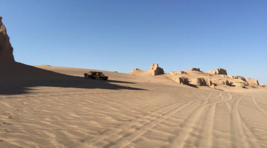
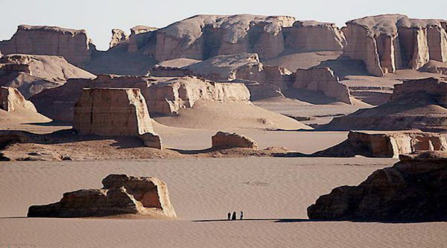
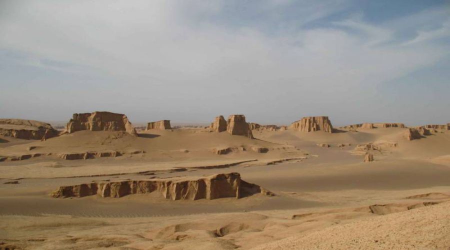
The desert soil is covered with sand and pebbles; there are marshes, seasonal lakes, and seasonal river beds. The hot temperatures cause extreme vaporization, which leaves the marshes and mud grounds with large crusts of salt. Heavy storms frequently occur and they can cause sand hills reaching up to 40 m in height. Some parts of Dasht- e Kavir have a more steppe-like appearance.
The Kavir was a series of vast lakes in the immediate postglacial time, stretching to about 3,000 years ago. The Asian monsoon rain reached deep into central Iran at the time, bringing heavy summer rain that formed numerous lakes in the closed basins of central Iranian Plateau that form the Kavir and other deserts in the area. There are inscriptions at teppeh Sialk noting a visit by the local queen to the ruler of the town, identified as Tell-i Bakun, southeast of Yazd, by “sailing the sea”! Copious shorelines at various elevations still extant in the Kavir tell tales of these post-glacial, monsoonal lakes in central Iran where the desserts now dominate.
Vegetation in the Dasht-e Kavir is adapted to the hot and arid climate as well as to the saline soil in which it is rooted. Common plant species like shrubs and grasses can only be found in some valleys and on mountain tops. The most widespread plant is mugwort.
The Persian ground jay is a bird species living in some parts of the desert plateaus, along with Houbara bustards, larks and sandgrouses.
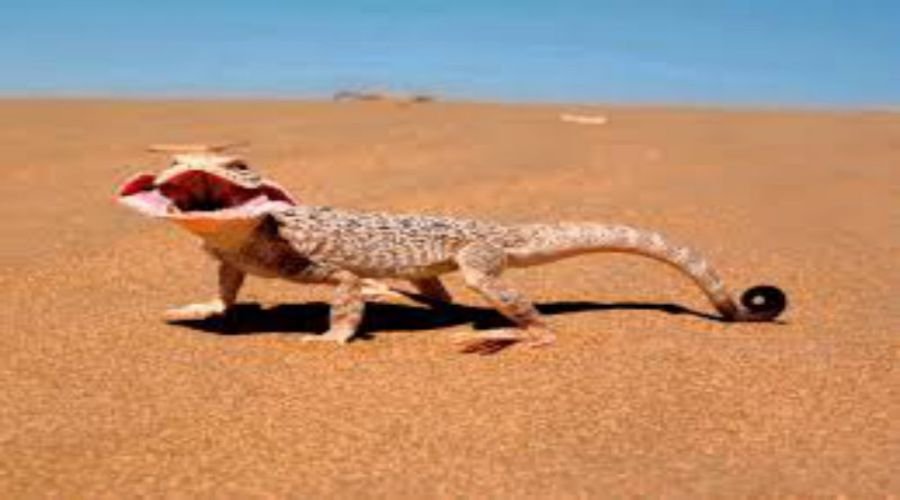
Persian gazelles live in parts of steppe and desert areas of the central plateau. Wild sheep (Ovis Orientalis), camels, goats (Capra aegagrus) and Persian leopards are common in mountainous areas. Night life brings on wild cats, wolves, foxes, and other carnivores. In some parts of the desert, the Persian onager (gur in Persian) and sometimes even the Asiatic cheetah can be seen. Lizards and snakes live in different places in the central plateau.
The extreme heat and many storms in the Dasht-e Kavir cause extensive erosion, which makes it almost impossible to cultivate the lands. The desert is almost uninhabited and knows little exploitation. Camel and sheep breeding and agriculture are the sources of living to the few people living on its soil. Human settling is restricted to some cases, where wind-blocking housing constructions are raised to deal with the harsh weather conditions. For irrigation, Iranians developed a sophisticated system of water-wells known as qanats. These are still in use, and modern globally used water-revenue systems are based on their techniques.
Get Social